How GEOMAR leverages immersive VR and moreViz to extend the impact of deep-sea expeditions, foster collaborative analysis, and engage stakeholders in evidence-based ocean policy.
Readtime: 6 Minutes
In ocean research, time isn’t just precious — it’s expensive. Every second of deep-sea exploration can cost around €1, making fieldwork one of the most resource-intensive parts of marine science. To maximize the return on this investment, GEOMAR Helmholtz Centre for Ocean Research Kiel turned to immersive visualization.
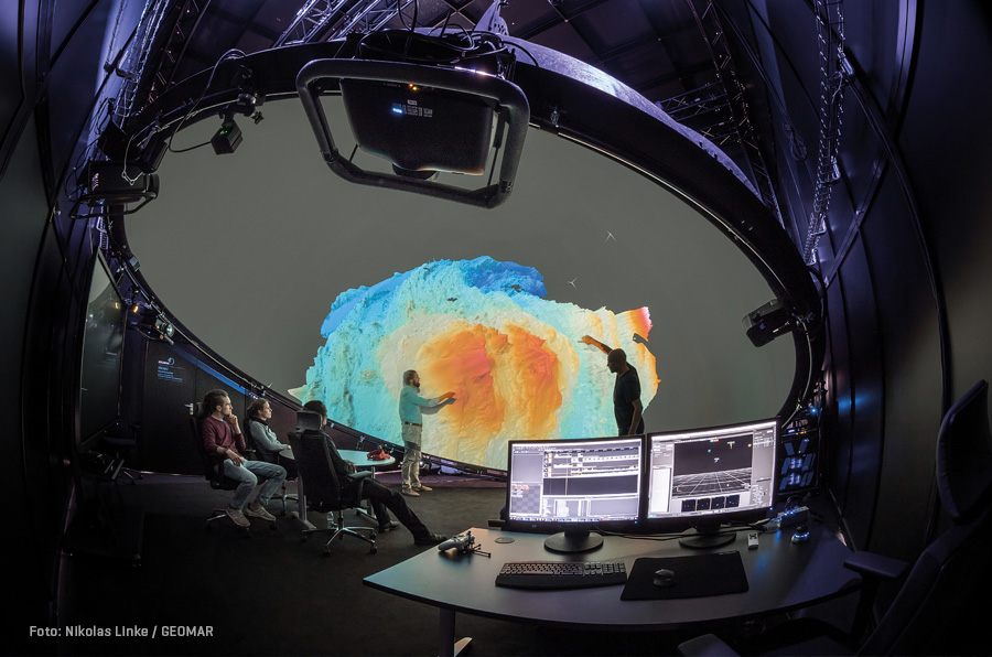
By combining a custom-built 6-meter VR dome with more3D’s moreViz software, GEOMAR created a shared, interactive space where scientists, students, and policymakers can collaboratively explore high-resolution ocean data — long after the ship has returned to shore. The result: a powerful tool for scientific analysis, stakeholder engagement, and reproducible discovery.
“Exploring the deep sea is like exploring outer space — remote, complex, and full of unknowns. Just right here on our planet. With VR, we turn these hidden worlds into something we can see, understand, and discuss together.”
— Dr. Tom Kwasnitschka, GEOMAR
Client Profile: GEOMAR Helmholtz Centre for Ocean Research Kiel
GEOMAR is one of Europe’s leading marine research institutions, conducting interdisciplinary studies of the ocean’s chemical, physical, biological, and geological processes. It is also actively engaged in 3D ocean floor mapping.
As a trusted advisor on environmental and policy issues, GEOMAR merges fundamental research with applied science to address urgent challenges — from marine hazards to sustainable resource use. The institute is internationally recognized for its deep-sea expeditions, high-resolution data collection, and commitment to turning scientific insight into public and political action.
The Challenge
Deep-sea research is complex, logistically demanding, and extraordinarily expensive — placing researchers under immense time pressure during expeditions. GEOMAR faced several critical challenges:
- Limited reusability of data once missions concluded, especially when viewed only on 2D screens
- Lack of shared spatial understanding among team members and students. While geologists typically rely on field experience to develop spatial intuition, this isn’t feasible in the deep sea, where scientists depend on robots, drones, and remotely operated cameras. VR opens new opportunities in this regard.
- Difficulty communicating findings to policymakers, stakeholders, or even fellow scientists who weren’t present on the original expedition. Static photos and videos often fail to convey the scale and context of complex sites.
As a result, highly valuable datasets were often underutilized, limiting their scientific and societal impact.
The VR Dome Solution
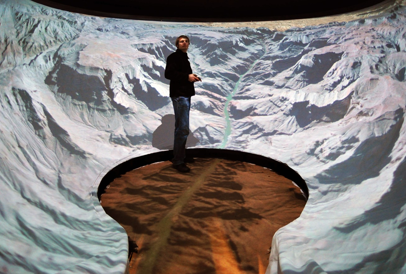
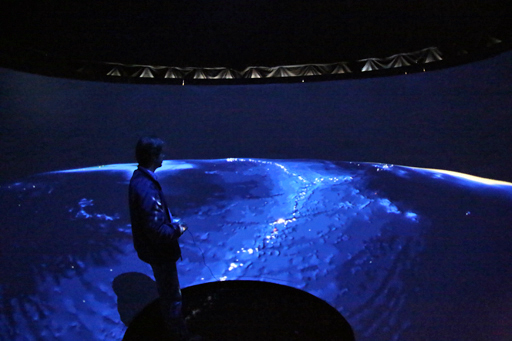
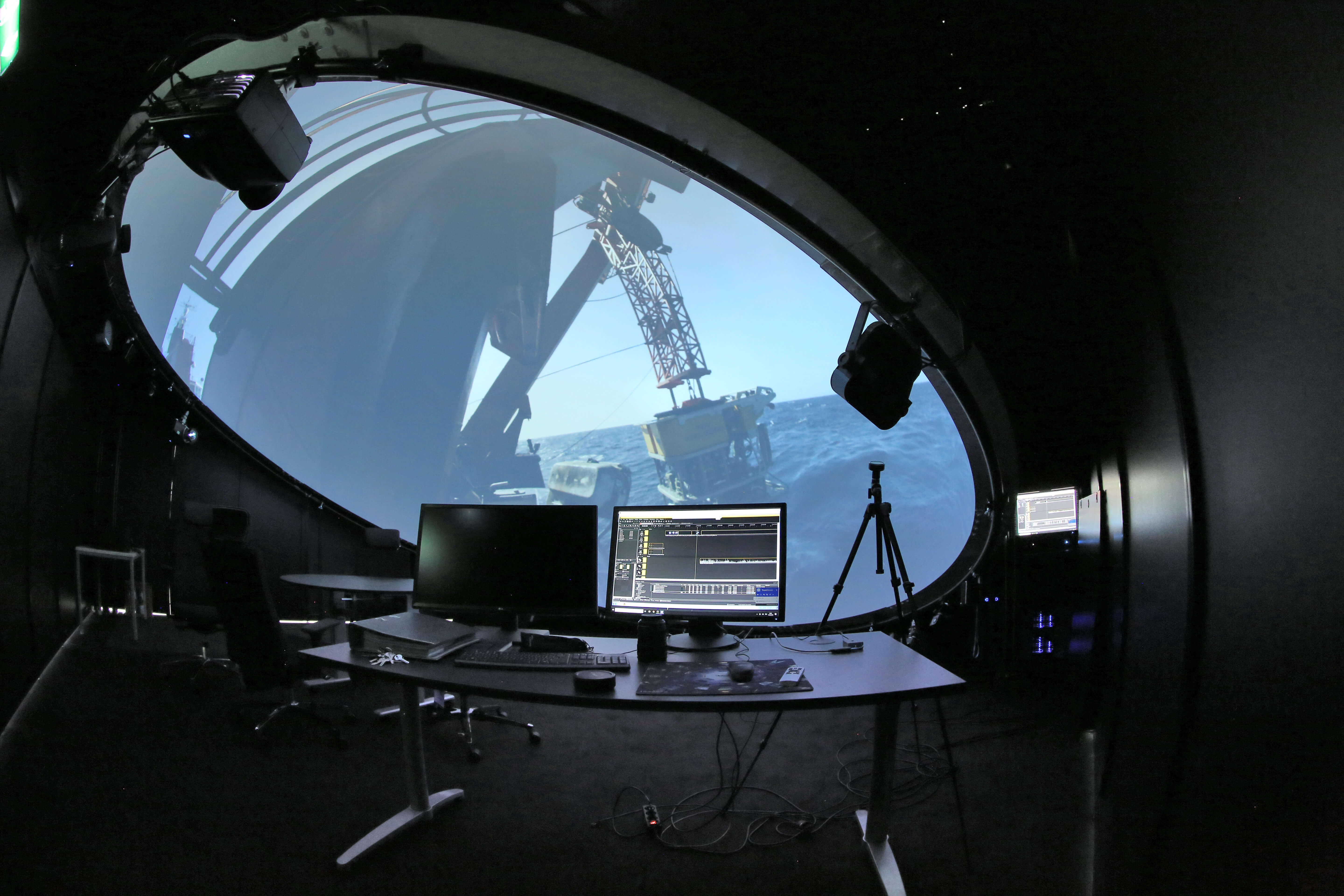
To address these issues, GEOMAR installed a custom VR dome — an immersive environment where 3D ocean data can be explored collaboratively, interactively, and in context.
Technical Overview
| Feature | Specification / Detail |
| Type | 360° immersive dome (planetarium-style) |
| Initial Setup | First dome in 2008; current system installed in 2019 |
| Diameter | 6 meters |
| Construction | GFK (glass fiber reinforced plastic) with OptiTrack tracking system |
| Projection System | Multi-projector setup with Barco systems |
| Audio | Integrated surround sound |
| Computing Hardware | Windows-based PC cluster |
| Software | moreViz (by more3D), enabling use of SolidWorks, Fledermaus, Metashape, Petrel and more — without conversion |
| Initial Investment | < €250,000 (plus an additional €200,000 upgrade for system expansion) |
The dome is freely suspended and angle-adjustable, allowing precise alignment and adjustment to suit the current research task.
Impact & Benefits
The integration of immersive VR has dramatically improved how GEOMAR uses, shares, and interprets marine research data – and that in high resolution.
- Improved data validation: Researchers can perform volumetric plausibility checks directly in VR, spotting errors or confirming results visually.
- Greater reproducibility: Immersive analysis preserves the usefulness of datasets beyond field campaigns, reducing the need for repeat missions.
- Enhanced collaboration: Unlike head-mounted displays, the dome enables true shared immersion. Everyone sees the same spatial context — with no edges like in a CAVE system, allowing for more natural interaction and dialogue. This streamlines discussions and eliminates misunderstandings.
“That old running gag among fishermen — ‘the fish gets bigger every time the story is told’ — doesn’t hold up in VR. In the dome, everyone sees in real size how big the fish was. VR takes the myth out of the tale and shortens the debate.”
— Dr. Tom Kwasnitschka, GEOMAR
- Decision theatre: The dome supports science-based discussions on topics like marine mining, habitat protection, and submarine hazards — with clarity and visual impact.
- Emotional connection: High-profile guests and policy stakeholders gain a visceral, intuitive understanding of ocean issues — far beyond what charts or reports can deliver.
“The VR dome helps us address urgent societal and political questions. It’s not just about seeing the ocean — it’s about working with the data in a way that moves science and policy forward.”
— Dr. Tom Kwasnitschka, GEOMAR
Why moreViz Made the Difference
Traditionally, bringing scientific datasets into VR required expensive development, tool changes, or time-consuming data conversion. moreViz changed that.
With moreViz, GEOMAR could:
- Continue using familiar tools and bring their work directly into the dome
- Skip conversion steps, preserving fidelity and saving time
- Combine multiple data sources in a single immersive scene via composition mode
- More than just visualizing, it enables real interaction and working with data: cutting, measuring, and navigating
- Prototype immersive workflows without costly implementation commitments
““Scientists are often reluctant to adopt new tools — not because they fear change, but because switching can be costly. Ideally, there’s no need to change workflows or convert data. You simply use what you already have — and step into immersive 3D.”
— Dr. Tom Kwasnitschka, GEOMAR
Beyond the technical strengths, more3D’s willingness to work within the financial constraints of a research institution was a decisive advantage. The solution is not only effective — it’s cost-efficient, scalable, and sustainable in the long term.
Lessons Learned
GEOMAR’s experience offers valuable insights for others considering immersive visualization in research:
- Start with purpose: A dome isn’t a short-term showpiece. Long-term success requires a clear strategy, well-defined use cases, and integration into real workflows.
- Design for usability: Beyond technology, the room itself should be welcoming and comfortable. A professional setup increases engagement and acceptance. With a smart technical setup it operation cost can be also significantly lowered.
- Maintain strategically: With one dedicated technical lead and thoughtful scheduling, GEOMAR keeps the dome running smoothly and cost-effectively — while minimizing hardware wear and energy waste.
- Communicate value: Visualization must prove its scientific value — not just look impressive. Having defensible, reproducible data exploration helps counter the idea that “visualization isn’t science.”
Looking Ahead
For GEOMAR, immersive VR is more than a visualization trend — it’s a core strategy to bridge science, education, and policy. As data grows in scale and complexity, tools like moreViz will play a critical role in turning information into action.
“Immersive VR is a communication tool. It helps us explore findings — and negotiate their meaning — together. As data can also be shared globally over the internet, a truly global discussion forum will emerge.”
— Dr. Tom Kwasnitschka
By embedding immersive visualization into scientific workflows and stakeholder dialogue, GEOMAR isn’t just visualizing the ocean — it’s reshaping how we understand, discuss, and act on it.